Joslyn van der Moolen | 07.03.2019
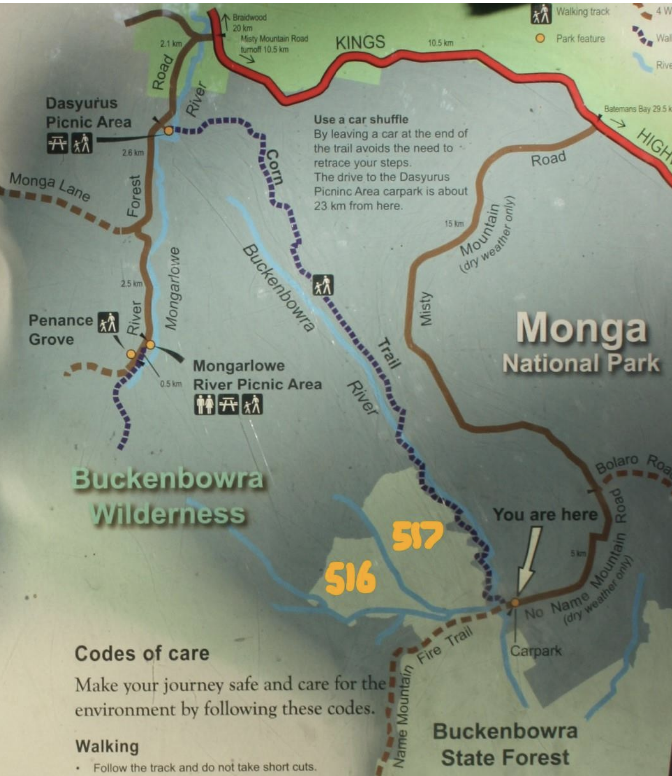
The Missing Heart of the Monga National Park – Corn Trail Stop logging compartment 517 while this area is considered for inclusion in the Monga National Park or at least a Preserved Forest Area while with State Forest Don’t post harvest burn compartment 517 after the logging due to risk of fire escaping into Monga National Park Don’t log Compartment 516 Support State Heritage listing of the Corn Trail This area was not included when Monga National Park was gazetted but it should have been. Forestry Corporation NSW advised the logging would start in 2019 however Friends discovered the logging started in late October at log dump 11. The Corn Trail is of great significance as this traditional indigenous walkway was used to travel from the tablelands to the coast as evidenced by the scar tree found by Friends right next to the logging boundary. It is also rich in post “settlement” history and is of immense recreational value to many user groups.


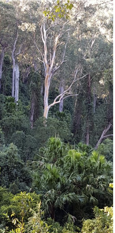
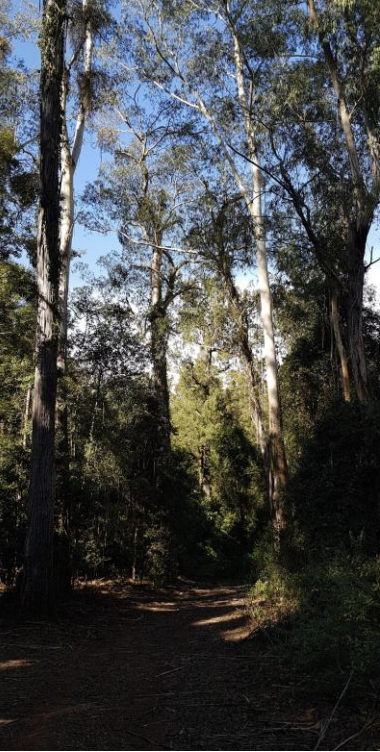
Steep hills with rainforest including very tall cabbage palm trees viewed from the Corn Trail adjacent to compartment 517. Logging starts right next to the national park boundary at the tree line visible in this photo on the left. The photo on the right shows logging compartment 517 Road. After the entire treetop is left behind to be burnt, the piece of stem that fits in the truck will become pulp (34%), firewood/misc (28%), high quality sawlog (22%) and salvage sawlog (11%).
The harvest plans maps at the start of the harvest plan show:
- there is no buffer next to Monga National Park which has the bottom quarter of the Corn Trial going close (50m) to the compartment boundary.
- only one section of rainforest has been mapped and marked for exclusion despite the harvest plan stating that the FT (Forest Technician) ‘’must search for and mark all areas of unmapped rainforest” page 12. Friends has already written to the EPA and demanded all rainforest be mapped and been advised Forestry will look of it prior to harvesting. The harvest plan must be reissued with the rainforest fully mapped for transparency and accountability. The logging dump right next to the only section of rainforest, marked out for protection has been completely cleared. Rianforest trees, tree ferns and cabbage palms have all been cut down or damaged.
- there is no 12 hectare exclusion zone as required by the presence of a Spotted Tail Quoll record in the bottom rhs corner of the map. Friends has photographed two quolls in the compartment.
- all glider sap feed trees, stands of forest oaks and forest oak trees must be marked for retention. The top of compartment road 517/2 and the full length of compartment road 517/7 is regrown with forest oaks but has not been mapped for protection.
- there has been no on the ground cultural survey for indigenous or post “settlement” historical sites. The scar tree the Friends groups found in the national park buffer, is very close to the logging compartment boundary is at risk of being “accidentally” cut down as it is a silvertop ash. Forestry staff are only required to be present 20% of the time. Private logging conctractors work unsupervised most of the time. The area is very steep as twenty six per cent of the area is 20 – 25 degrees slope and sixteen per cent is 25 to 30 degrees. It is also subject to high rainfall. Despite this 294 hectares of the total 348 total hectares of Compartment 517 are earmarked for logging. The Expected Yield figures show that these beautiful silvertop ash, yellow stringybark and brown barrel forests will be cut down for pulp 34%, firewood and miscellaneous 28% salvage sawlog 11% with only 22% for high quality sawlogs. These figures don’t account for most of the tree being left on the forest floor to be burnt – estimated to be up to 65%

